In a groundbreaking initiative to protect marine ecosystems, CEDARE (Centre for Environment and Development for the Arab Region and Europe) partnered with the Egyptian National Authority for Remote Sensing and Space Sciences (Narss) and the Egyptian Environmental Affairs Agency (EEAA) under the MarCNoWA (Management of Marine and Coastal Areas of North and West Africa) project. This collaboration combines cutting-edge satellite technology with local expertise to address the critical issue of oil spills along Egypt’s Mediterranean and Red Sea coasts—vital ecosystems for biodiversity and economic activity.
Advanced Satellite Surveillance
The project utilizes Sentinel-2 satellites from the European Union’s Copernicus Programme, providing daily, high-resolution (10-meter) monitoring of Egypt’s territorial waters. These satellites’ multispectral imaging capabilities allow for:
• Real-time detection of oil slicks through spectral analysis of surface anomalies
• Automated calculation of spill areas using GIS tools, with an accuracy within ±5%
• Timestamped incident reports, reducing response time to under 6 hours
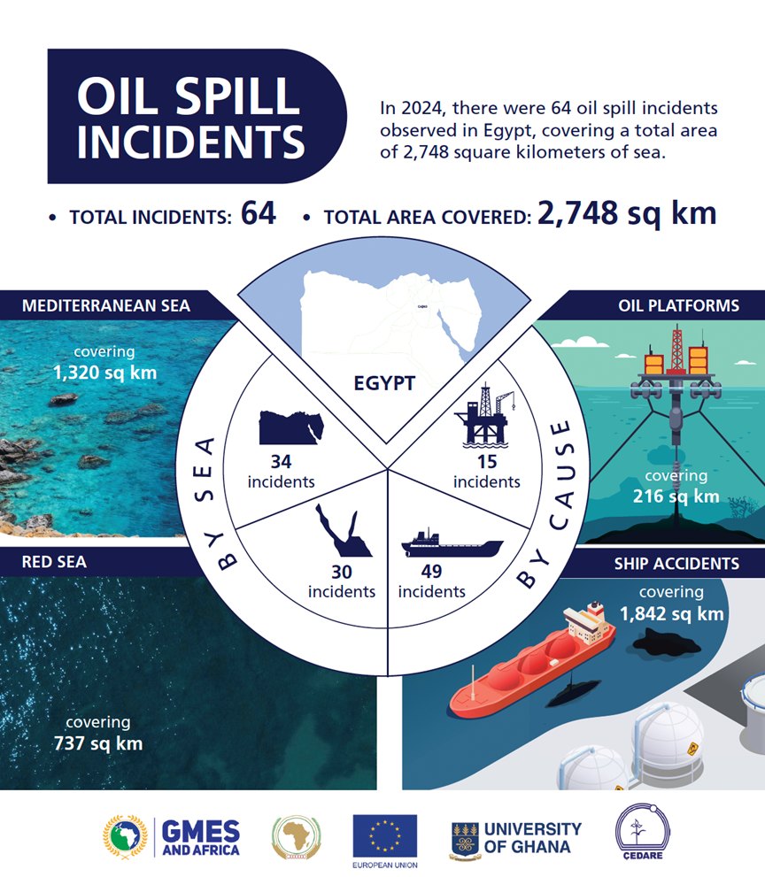
2024 Impact Report Highlights
Preliminary data from January–December 2024 reveals:
Metric Mediterranean Sea Red Sea
Detected spills 34 30
Average spill size 39 km² 24 km²
Maximum spill size 184 km² 110 km²
Institutional Coordination
The operational workflow involves close collaboration between all parties:
1. NARSS processes raw satellite data using proprietary algorithms.
2. CEDARE validates findings and generates incident reports.
3. EEAA mobilizes containment vessels and coordinates with port authorities.
Dr. Omar Elbadawy, Project Lead of Marcnowa-Cedare, shared, “This synergy of space technology and rapid response protocols sets a new standard for marine conservation in Africa. Our detection system now achieves 94% accuracy in distinguishing petroleum films.”
Future Expansion
Plans are underway to integrate AI-powered Synthetic Aperture Radar (SAR) data from Sentinel-1 satellites for all-weather monitoring. This tripartite initiative showcases Egypt’s leadership in environmental stewardship and offers a replicable model for coastal nations tackling marine pollution.
